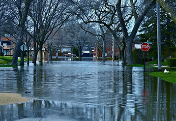
 A new, nationwide flood modeling tool released in late June shows that many Americans are unprepared for damaging floods.
An analysis conducted by the First Street Foundation, a nonprofit comprised of scientists, engineers, and researchers, combined existing models climate change, sea level rises, and extreme weather events to create an updated flood assessment model.
The new models estimate that nearly 40 thousand Vermont properties face a 1 percent annual chance of flooding. Current maps identify only 13,000 properties in floodplains (205.5 percent less than the new model).
The highest discrepancies in the state are in Windsor and Washington counties, where 4,147 and 3.540 properties are at risk of flooding but are not currently listed on the federal flood maps.